")

")
")

")


Plan your Urumqi tour? Xinjiang is a good place, the largest provincial-level region in China, officially named Xinjiang Uyghur Autonomous Region. Xinjiang spans 1.6 million km2 ( comparable in size to 3 Frances), and covers an area of about one sixth of the China’s territory.
The charm of Xinjiang lies on its diversified ethnic cultures, and unique geography and topography. The best time to explore Xinjiang is between June and October. Follow me to have a virtual photo tour of Xinjiang.
Nestled high and below the snow-capped Bogda Peak in the Tianshan Mountains, 66 kilometers to the northeast of Urumqi.
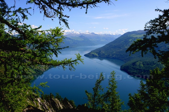
The Kanas Lake is nestled in a valley of the Altai Mountains, to the northern tip of Xinjiang, bordering with Kazakhstan, Mongolia, and Russia.
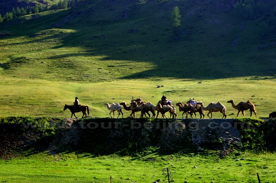
The Area around Kanas Lake is mainly inhabited by the ehtnic group called “Kazakhs” in Xinjiang who speak Kazakh, which is the Kipchak branch of the Turkic language sect in the Altaic language Family. Kazakh nomads migrate seasonally looking for pastures to feed their livestock.
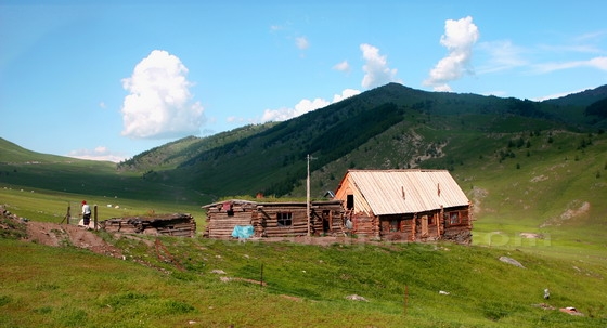
Kazakh nomads’ Summer House. Kazakhs stay on the high moutains in summer and settled down to the village in winter.
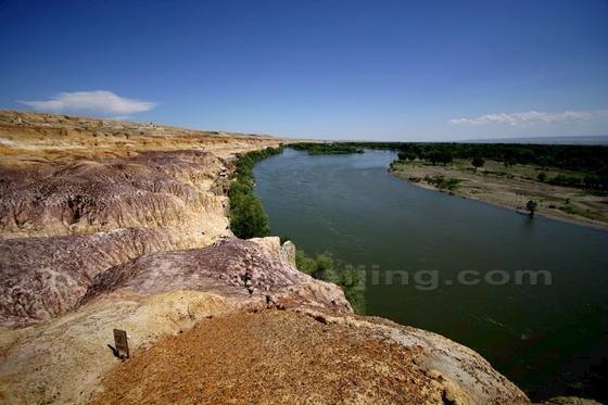
5-colored hills, or Rainbow Beach of Xinjiang. The international river – the Irtysh (Ertix) River passing through in northern Xinjiang.
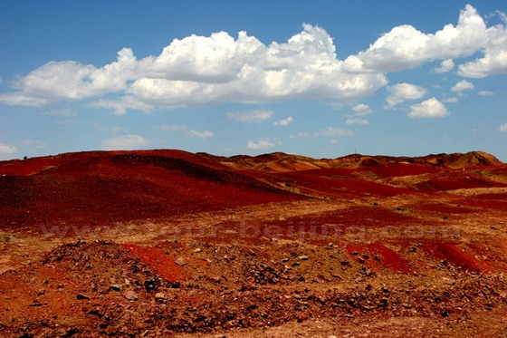
Turpan is well known for its Flaming Mountain, which are barren, eroded, red sandstone hills near the northern edge of the Taklamakan Desert and east of the city of Turpan.
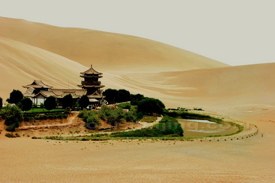
The iconic crescent-shaped lake in an oasis, 6 km south of the city of Dunhuang.
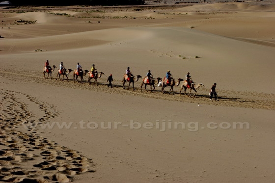
Camel riding is a good way to experience the silk road culture and traditional customs.
Jiayuguan Pass at the western tip of the Great Wall of China starting from the eastern tip of Laolongtou section of the Great Wall that meets the sea.

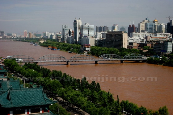
The Yellow River cuts through the city of Lanzhou
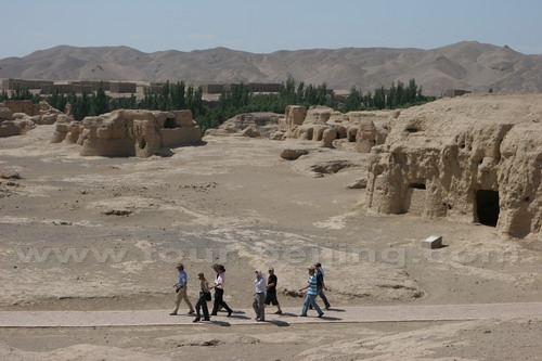
The Gaochang ruins. Gaochang Ancient City is located at the east of Turpan.
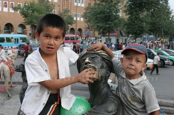
Xinjiang Boys palying at Erdaoqiao, Urumqi
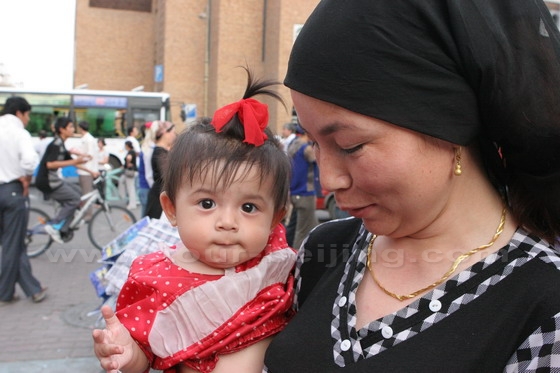
Xinjiang Mother and Baby
Tip: Hassle-free Urumqi Guided Tours
 If you don’t want to go the do-it-yourself route and prefer the hassle-free escorted tours, here are some options for Urumqi Guided Tours:
Urumqi Highlight Day Tour from US$119 p/p
Urumqi Pasture Excursion Day Tour from US$89 p/p
Urumqi 4 Day Tour from US$419 p/p
Urumqi Turpan 4-Day Tour from US$325 p/p
Further Readings
Top 10 Attractions in Urumqi
Best Urumqi Photos
How to get from Beijing to Urumqi
Any questions, just drop a line.
Great photos…but if you claim that these are the “best Xinjiang photos” you might not want to include photos from another province like Gansu. They are not the same.
Hello Josh,
Yes, you are right. The title should be Xinjiang and Gansu Photos, or Photos along the Silk Road. Thanks for your kind feedback!